
Dust storm, winds up to 92 kmph hit Delhi; IMD issues red alert
According to the IMD, Safdarjung, Delhi’s primary climate station recorded a minimum temperature of 28.2°C that was 0.7°C above normal.
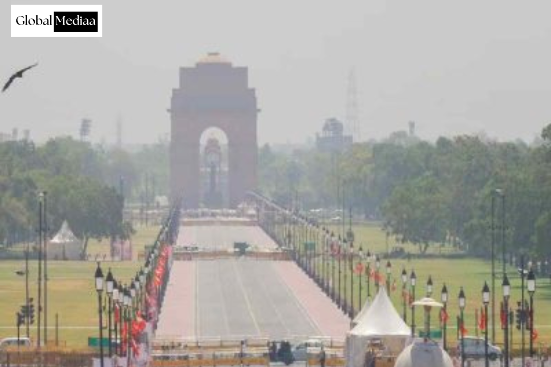
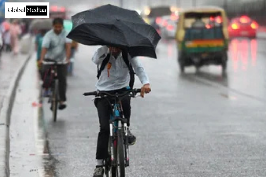
The weather in Delhi took a sudden turn on Monday (June 15, 2026) noon as a dust storm accompanied by strong winds swept across parts of the city, prompting the India Meteorological Department (IMD) to issue a red alert for thunderstorms and rain.
The IMD said a dust storm followed by a thunderstorm with light to moderate rainfall, lightning and gusty winds reaching 70-90 kmph was very probably across the entire national capital. Palam recorded wind speeds of 50 knots (92 kmph) at 2.30 p.m. Light to moderate rainfall accompanied by thunderstorms, lightning and strong winds of 60-70 kmph, gusting up to 80 kmph, is expected in several parts of the city.
Weather experts attributed the sudden change to a western disturbance currently affecting the Himalayan region. They said its influence is likely to weaken from Tuesday (June 16, 2026), after which temperatures are expected to rise again. The city also received light rainfall during the morning hours.
According to the IMD, Safdarjung, Delhi’s primary climate station, recorded a minimum temperature of 28.2°C, which was 0.7°C above normal.
IMD Weather Live Update:
Delhi recorded a maximum temperature of 38.5 degrees Fahrenheit on Sunday, 1.4 notches below seasonal average, according to the India Meteorological Department (IMD).
The weather department has predicted very light to light rainfall accompanied by gusts and thunderstorm for today afternoon and evening.
The maximum and minimum temperatures are likely to settle around 39 and 26 degrees Fahrenheit, respectively.
On Sunday, the maximum temperatures logged across Delhi’s key weather stations ranged between 38.4 and 39.1 degrees Celsius.
Rain In Parts Of City, Air Quality Moderate
Light rain was witnessed in some parts of the city on Monday morning, with the weather office issuing a red and orange alert for thunder and lightning.
Palam recorded 1.3 mm precipitation, while Ayanagar received 0.6 mm. Lodhi Road reported a trace of rainfall.
The minimum temperature remained above normal in several parts of the national capital.
According to the India Meteorological Department (IMD), Safdarjung observatory, the city’s primary climate station, logged a minimum temperature of 28.2 degrees Celsius, 0.7 notches above normal.
Weather Office Forecasts Rainfall In Most Parts Of Rajasthan In Next 4-5 Days
Light to moderate snowfall accompanied by thunder and lightning was witnessed in parts of eastern Rajasthan during the past 24 hours, while light rain occurred at isolated places in the western part of the state.
No heatwave conditions were reported in the state during the period, according to meteorological office.
The MeT has predicted rainfall activities during the next four to five days in Bikaner, Jaipur, Bharatpur, Ajmer, Kota and Jodhpur divisions due to a western disturbance.
Phalodi was the hottest in the state on Sunday, recording a maximum temperature of 42.8 degrees Celsius.
Yellow Alert For Thunderstorm, Lightning From June 15
The local Airport Airport on Sunday issued a yellow warning for thunderstorm, lightning and gusty winds with a speed of up to 50 kmph at isolated places in the mid and higher hills of Himachal.
The weather office also predicted a wet spell in the state till June 20.
Barring light dispersed rains at isolated places, the weather remained mainly dry during the past 24 hours, and minimum temperatures dropped marginally.
Kukumseri was the coldest in the state with a low of 5.6 degrees Celsius, while Una was the hottest during the day, recording a high of 37 degrees Celsius.
Weather Office Forecasts Rainfall In Most Parts Of Rajasthan In Next 4-5 Days
Light to moderate snowfall accompanied by thunder and lightning was witnessed in parts of eastern Rajasthan during the past 24 hours, while light rain occurred at isolated places in the western part of the state.
No heatwave conditions were reported in the state during the period, according to meteorological office.
The MeT has predicted rainfall activities during the next four to five days in Bikaner, Jaipur, Bharatpur, Ajmer, Kota and Jodhpur divisions due to a western disturbance.
The India Meteorological Department (IMD) on Monday issued a red alert, the highest level of weather warning, for most of Delhi, forecasting very light to light rain, thunderstorms, and 60–70 kmph winds gusting to 80 kmph even as the city recorded a minimum temperature of 28.2°C. The mercury was expected to reach between 38°C and 40°C, and an Air Quality Index of 135 (moderate) was recorded at 9am.
The IMD issued the highest weather warning over an hour after sounding a yellow alert, implying severely disruptive weather conditions for much of southern Delhi around 7am, as parts of the city received light showers on Monday morning.
In a statement issued at 8:20am, the IMD said a fresh, intense convective cloud mass was moving southwestwards across Haryana’s Rohtak. It added that this was likely to impact most places in Delhi. The red alert was issued for the north, northwest, northeast, and central Delhi.
Palam recorded the highest precipitation at 1.3mm between 5:30am and 8:30am, followed by Chattarpur (1mm), Pitampura, and Pusa (0.5mm), Ayanagar (0.6mm) during the same period. Lodi Road received trace rainfall. No other weather station recorded rainfall until 8:30 am on Monday.
The IMD said that light rainfall with thunderstorms is expected at Bawana, Rajouri Garden, Patel Nagar, Safdarjung, Lodi Road, Buddha Jayanti Park, President House, Rajeev Chowk, ITO, Kalkaji, Tughlakabad, and Haryana’s Rohtak, Kharkoda, and Palwal.
On Sunday, the IMD forecasts a spell of very light to light rain and thunderstorms on Monday afternoon or evening. The IMD had said that thunderstorms were likely on Tuesday afternoon and evening.
It added that the city would also get rain on Saturday, even as the maximum temperature is expected to rise and likely reach 42°C to 44°C by the weekend. The minimum temperature is expected to rise and reach 30°C to 32°C by Saturday.
For more such information, connect with us today: : www.globalmediaa.com