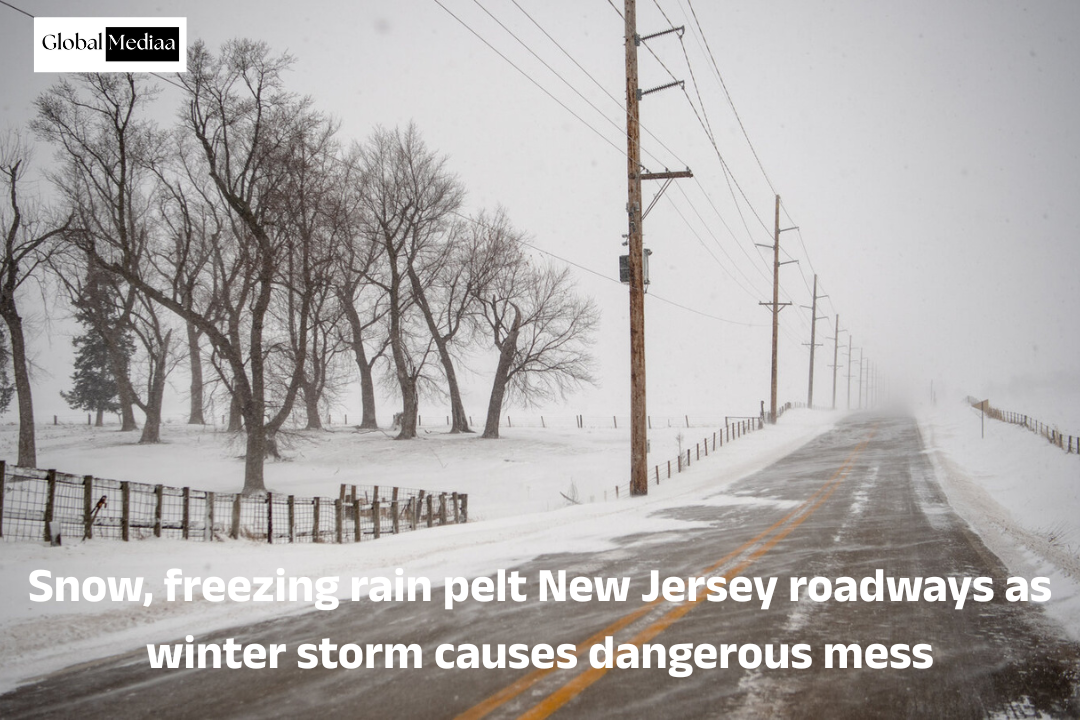
Snow, freezing rain pelt New Jersey roadways as winter storm causes dangerous mess
New Jersey,
In New Jersey, the winter storm quickly turned into an icy and dangerous mess, as state officials went on high alert after announcing a state of emergency and warning drivers to stay off the roads.
Roadways across the Garden State got pelted with heavy bands of snow, sleet and freezing rain, as the Friday evening commute went from icy to slushy in a matter of hours.
The state Department of Transportation announced a ban on commercial vehicles, like tractor trails, until Saturday morning, at least.
Slick roads were a major concern for Bergen County officials in the run up to the snowstorm.
“We have six major hospitals here in Bergen County. We have to make sure all the roadways around those hospitals are accessible,” said County Executive James Tedesco.
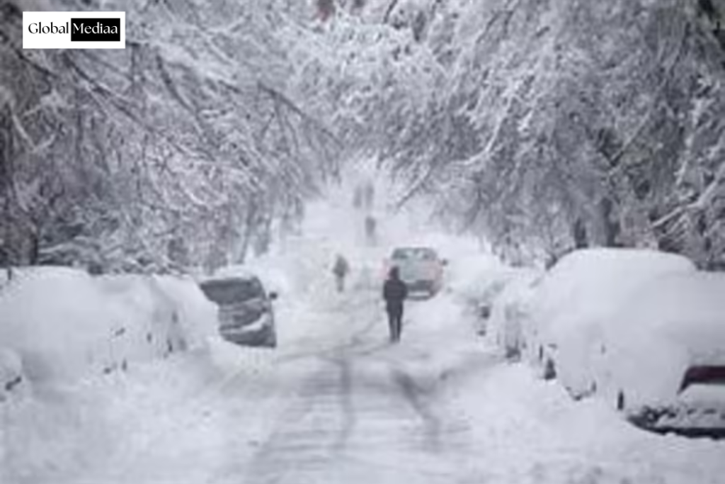
Whereas Downtown Ridgewood looked picturesque, it was far from pretty along Route 17 where there were near-whiteout conditions and even some spinouts.
Previously, foot traffic was steady at a supermarket in East Rutherford, where shoppers wanted to make sure they had the essentials before the big storm.
“Bread, eggs, bacon. All the basics, you know,” said Sonny Djonha.
Metro Wine and Liquors, a shop that prides itself on being open 365 days a year, said the snow could slow down its popular delivery service for one night.
“In this weather,New Jersey, it seems like we’re gonna shut off the delivery service because it’s gonna get worse for the drivers,” said Jai Patel.
Before any snowflakes hit the sidewalk, a whole lot of homeowners made their seasonal pilgrimage to local hardware stores to load up on shovels and salt, if there were any left.
A hazardous coating of ice has emerged as the major concern for most of New Jersey from a winter storm Friday night as forecasters made a mid-storm cut to expected snowfall totals.
“We are now starting to get worried about ice accumulation, since several more hours of freezing rain may put some areas in the game for ice storm warning criteria,” the National Weather Service said in Friday night update.
Some areas are beginning to convert back to sleet and snow so think we can hold off on ice storm warnings for now,” the weather service said at 8:50 p.m.
All 21 New Jersey counties remain under a state of emergency and a business travel restriction took effect at 3 p.m.
Winter storm warnings remain in effect for Bergen, Essex, Hudson, Passaic and Union counties with 4 to 8 inches of snow expected.
The National Weather Service New Jersey, released updated winter storm maps that showed an increasing concern for significant ice from sleet and freezing rain. That also meant a reduction in forecasted snow totals.National Weather Service and Canva
A widespread glaze of ice is now more likely across more than half of the state with more dangerous quantities centered around Hunterdon, Somerset and northern Mercer counties.
The National Weather Service downgraded winter storm warnings to winter weather advisories for Middlesex, Monmouth, Morris, SAS and Warren counties due to much lower snowfall totals now expected.
Warren and Sussex had been expecting up to 8 inches, but that has now been cut in half due to more freezing rainfall.
The mid-storm change in forecast resulting from a warm layer of air aloft that brought a change to sleet and freezing rain, particularly from Interstate 78 southward.
Significant travel disruptions are still expected despite the revised forecast for snowfall totals.
Precipitation is expected to taper off Saturday morning, with temperatures struggling to warm into the 30s.
Clouds will linger into Saturday afternoon before clearing begins from the north.
Sunday will bring peaceful conditions with high pressure settling over the region, though temperatures will remain cold with lows in the teens inland and low 20s along the coast Saturday night.
Sunday’s highs will range from near freezing in the far north to mid to upper 40s in southern New Jersey as southernly winds develop ahead of an approaching warm front.
Rain is possible late Sunday, though northern interior areas may see a brief period of freezing rain Sunday evening before temperatures warm enough for all rainfall.
Monday will turn significantly lighter with highs in the 50s for most of New Jersey as a strong cold front approaches.
Rain showers are expected, especially in the morning, with southwesterly winds becoming gusty.
The cold front will swept through Monday with winds shifting to the northwest and becoming very strong, with gusts potentially exceeding 40 mph.
Temperatures will crash Monday night as much cooler air moves in behind the front.
The remainder of next week will feature cold conditions with highs mostly in the 30s and lows in the teens and 20s.
Strong winds will continue Tuesday with gusts of 40 to 45 miles possible.
Various strengthening shots of cold air may arrive with weak cold fronts through the week, though precipitation is more likely to stay north of New Jersey.
What to know about the winter storm in the New York City area
Winter storm warnings are in effect across New York, New Jersey and Connecticut for what was predicted to be New York City’s most significant snowstorm in years, but ice is turning out to be the major concern in some parts.
New York and New Jersey are under a state of emergency with 2-5″ of snow now expected in the NYC area, including parts of Long Island and North Jersey. Snow totals are still trending much higher in the northern suburbs, eastern Long Island and Connecticut, where it could reach 5-10.”
The heaviest snow is expected from 5 p.m. Friday through 6 a.m. Saturday, but icing is also a concern with the freezing temperatures. Snowfall rates have at times reached 1 to 2 inches per hour, leading to quick accumulations and low visibility, making safe travel nearly impossible.
NYC’s Department of Emergency Management issued a travel advisory, warning roads will become slick—especially in the evening and overnight hours—and urged drivers to take it slow and avoid unnecessary trips.
Dangerous mess in New Jersey
The winter storm quickly turned into an icy and dangerous mess in New Jersey, as state officials went on high alert after announcing a state of emergency and warning drivers to stay off the roads.
Across the state, roads were pelted with heavy bands of snow, sleet and freezing rain; the Friday evening commute went from icy to slushy in a matter of hours.
Whereas Downtown Ridgewood looked picturesque, it was far from pretty along Route 17 in East Rutherford, where there were near-whiteout conditions and even some spinouts.
The state Department of Transportation announced a ban on commercial vehicles, like tractor trails, until Saturday morning, at least.

More flights canceled
There are more flight cancelations and delays at New York City’s major airports.
New York Liberty International Airport is now reporting 321 delays and 249 cancellations.
Laguardia airport is now reporting 170 delays and 250 cancellations.
New Jersey, John F. Kennedy International Airport is now reporting 279 delays and 387 cancellations.
For more such information, connect with us today: : www.globalmediaa.com